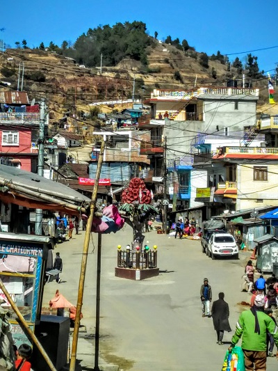

Based on geographical area, Tehrathum district is the smallest district of Province 1. When it comes to tourism map of the province, Tehrathum is not the small district. Despite having 679 square kilometer of area, Tehrathum has 119-kilometer-long connectivity via Mid-Hill highway and it borders with Taplejung, Panchthar, Dhankuta and Sankhuwasabha districts. From transit and travelling point of view, Tehrathum is the super accessible district, which hosts various natural wonders. Here are just five of them.
This is the longest known cave in the Province 1. The 145-meter-long cave lies in Chhathar Rural Municipality ward number 6 Sudap of Tehrathum. This cave is named in Limbu language. Chang means cluster and lung means stone i.e. Changlung stands for cluster of stone, which is reflected in the cave zone. There are multiple clusters of stones. It takes around an hour to circle the entire attractions within the cave area which also includes a tower, Shiwalaya temple and the likes. It is around 14 kilometer roadways from Sindhuwa of Dhankuta’s section of Koshi Highway. Likewise, it takes four hours of walk from district headquarters of Tehrathum. From vehicle, it is just around an hour to reach the cave area from Myanglung. Changlung is not only the destination. It is also a transit point to travel Sukrabare Bazaar and Marga Pokharai, two other attractions along the route. Sukrabare is the rural municipality headquarters and the Marga Pokhari is the famous local pond which is few minutes ride from a stretch of Sindhuwa Sukrabare roadways.
Located at Laligurans Municipality ward number 3 of Tehrathum, Cholung Park is reached within a minute ride from Mid-Hill highway section of Basantapur Bazaar, the municipality headquarters of Laligurans Municipality. Spanned over approximate area of 50 Ropanis, the park was officially inaugurated on 5 Push 2076 BS by Bairagi Kainla, the famed poet and cultural scholar of Nepal. Cholung Park is the only eco-friendly park in Province 1 where there is no use of concrete structures. The park premise is gardened with varied species of rhododendrons of Nepal. Of late, this park has stood as the must-go destination to film any Limbu related documentaries, music videos, movies and many other cultural archives. Cholung Park gets an average footfall of more than 100 visitors in a day. In hectic days of vacation, holidays and other touristic seasons like snowing and rhododendron bloom, the visitor’s digit skyrockets. Culturally, Cholung Park is the park indicating Limbu civilization. In Limbu language, Cho means target and lung means stone. In the park premises, there is also a Limbu cultural museum and the iconic 16-feet tall cultural stone.
TMJ is the officially known rhododendron capital of Nepal. Out of 32 available species of rhododendrons in Nepal, 28 species are found in TMJ. This fact is approved by INCN, the international organization working for environment and conservation. TMJ is an abbreviation form of Tinjure, Milke and Jaljale hilltops of Tehrathum, Sankhuwasabha and Taplejung districts of Province 1. Basantapur is the gateway town of TMJ. Declared in 1997 as the National Rhododendron Environmental Conservation Area by Nepal’s Ministry of Population and Environment, TMJ spans over 585.26 square kilometers of area with altitudinal variation from 1700 meter to 5000 meter. Basantapur is the only gateway to sneak into TMJ from vehicular travel. Basantapur has other attractions also like RR Garden which is combination of natural rocks and rhododendron. Tinjure hilltop is in close proximity of Basantapur. Basantapur also has a stone statue, which is famous for filming TikTok videos, vlogs and clicking pictures for visitors.
After around one and half hour drive from Basantapur along the hilly ridge of Tehrathum, Sankhuwasabha and Taplejung, one can reach Gupha Bazaar which is at an altitude of 2890 meter from the sea level. Next to Gupha Bazaar is Suke Bazaar (2910 meter). In addition, the Suke Bazaar is the base camp of Menchchyayem hilltop which is taller than 3000 meters. It takes around an hour uphill walk from Suke Bazaar to reach at the Menchchyayem hilltop. The hilltop stands as the trident of Tehrathum, Taplejung and Sankhuwasabha. From the hilltop, the mesmerizing northern Himalayan range that hosts peaks like Kanchanjunga, Makalu and Kumbhakarna, among others, are visible in clear skies. Almost all districts of Province 1 are visible from the hilltop. Menchchyayem is also a best venue of watching and enjoying sunrise and sundown. Hikers, bikers and motorists do visit this hilltop as it is connected via national highway. Though the highway is not blacktopped, it is not problematic for both two-wheelers and four-wheelers. A rural municipality of Tehrathum is named after Menchchyayem i.e. Menchchyayem Rural Municipality. It takes around five hours of walk from the rural municipality headquarters Morahang to Menchchyayem hilltop.
Before 2074 BS, Hyatrung waterfall of Tehrathum was the tallest waterfall of the nation. After the scientific measurement of Pachal waterfall of Kalikot district in 2074 BS by the local government, Hyatrung has slipped into the second tallest waterfall of Nepal. The 381-meter-tall Pachal waterfall of 16 meter taller than Hyatrung (365 meter). Still, the Hyatrung waterfall is the tallest waterfall of the Province 1. It is in close proximity of Mid-Hill highway. Located at the confluence of ward number 4 (Sandu) and ward number 5 (Ishibu) of Phedap Rural Municipality of Tehrathum, Hyatrung waterfall is reached within three hours of drive from district headquarters Myanglung. Local can reach within one and half hour because they are accustomed to the topography. As there is no hotels and home-stay in the vicinity of Hyatrung waterfall, visitors have to either shelter in the local homes or have to make timely return. The water volume is good enough in months from Baisakh to Ashoj. In other months, water volume is not so good to call it waterfall. The easiest vehicular route to visit the waterfall from Myanglung is via Myanglung, Halimela, Bhyagutte Dhunga, Batshe, and Sandu School.